
Exploring the Eagle Trail:
Peninsula State Park in Door County, Wisconsin

The rocky shoreline of Eagle Harbor
In the height of midsummer, I visited the northern woodlands of Wisconsin for the first time. It’s a gorgeous season in which to experience it. Flickers of sunlight sparkle across the rippling blue waters of the lake, as waves crest gently upon a shoreline of smooth white stone. Billowing sails of boats drift leisurely along the distant horizon. Dense clusters of cedar trees tower above, with swooping boughs and draping evergreen leaves. The scent of cedar wood hangs in the summer air, as emerald moss and wild ferns blanket the ground underfoot. Delicate purple wildflowers cling to the rocky terrain, entangling the forest floor. It’s a place that feels almost primordial--ancient, and sacred in the magnificence of its wilderness.

I was staying in Door County--a narrow peninsula that juts northward from the Green Bay area. According to legend, Door County earned its name from the reputation of “Death’s Door:” a treacherous sailing route that connected the waters of Lake Michigan into Green Bay. The perilous passage between the tip of the Door Peninsula and Washington Island is steeped in ominous lore originating from the Native American resident tribe, the Pottawattamie.
Enclosed by miles of beautiful coastline, Door County has a colorful charm and definitive holiday vibe. Enthusiastic vacationers frequent the beaches, parks, local shops, and cherry orchards. I came here after being hired by Peninsula Players Theatre as their scenic artist for the 2021 season. After painting the majority of the set, I had a free afternoon and was excited to explore the area.
Anxious to go hiking, I found a state park located near the town of Fish Creek, just north of where I was working. Peninsula State Park is a large mass of forested land connected by a rugged network of trails for biking, with open spaces to experience the rocky shoreline. There are various overlooks, a lighthouse, boat launches, historic cemeteries, a campground, an amphitheater, and a newly renovated Nature Center. The expanse of a large golf course borders the western side. The park was established in 1909, and is characterized by large swaths of undeveloped acreage, northern hardwood forests, wetlands, meadows, and dolostone cliffs.
I studied the summer map, tracing the various trail lines and searching for a good starting point. My eyes were drawn to the Eagle Trail: a rugged two-mile loop through the steep descent to Eagle Harbor that encircled a 200 foot elevation. The trail was given its name because bald eagles were once known to nest in the bluffs. I saw notes about exposed roots and rocky terrain, which was all I needed to decide.
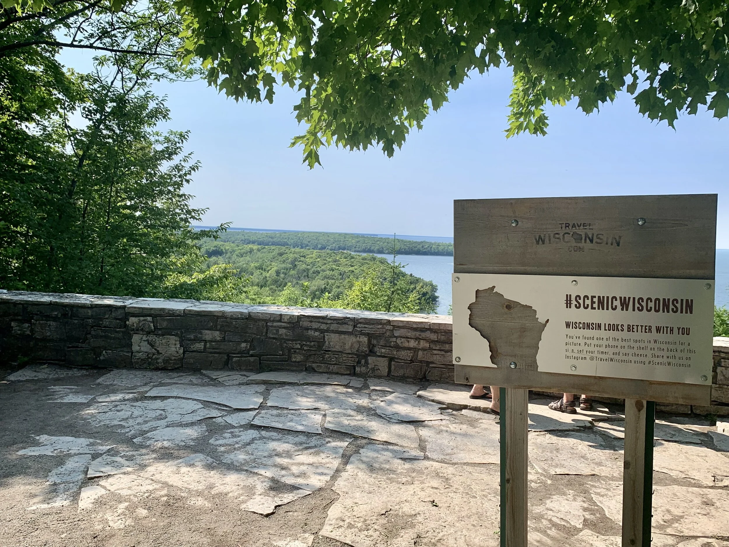
The Eagle Panorama
My hike began at the Eagle Panorama, a broad overlook that offers stunning views of shimmering water and infinite sky. The ascent of the Eagle Trail led me along a twisting, narrow route, on a path with entwined, exposed roots and dense forest canopy. I noticed wild daisies, bright ferns--and the remarkable height of the trees. Some were cedar--others birch, and beech. Peeling bark lay in curling scraps along the ground, the papery white shreds ensconced in feathery moss. The presence of these trees, and the dappled light throughout--it was mystical. Especially in the afternoon, which lent a striking contrast to the layers of leaves as direct sun filtered through. Everything had an ethereal, greenish haze to it, cast from the density of the canopy. This was an enchanting place--and it felt very old.


As I moved through the forested part of the trail, I began the descent along more rocky terrain. This area is part of a stone formation called the Niagara Escarpment, which curves east to west along the Great Lakes and US/Canadian border. The escarpment begins at Niagara Falls and continues to the northwestern tip of Illinois, near the Wisconsin state line.
What makes this particular area unique is the composition of the rock formation. During the Ordovician Age, world sea levels were at their peak. In fact, the entirety of the midwestern United States was once covered by a shallow sea, teeming with shelled creatures and marine life. I recently learned about this while researching crinoids, after purchasing my first fossil of a sea lily. When the waters receded, the calcium carbonate minerals from marine life became a sedimentary limestone known as dolomite. This dolomitic limestone (dolostone) formed a hardened caprock over the more delicate shale beneath, protecting the bluffs from heavy erosion and preserving the former shoreline. These unique ecological circumstances are what created the towering 150-foot bluffs of Eagle Harbor. And, the dolomite basin--the floor of this Ordovician Silurian tropical sea--extends to Lakes Michigan, Huron, and Eerie.


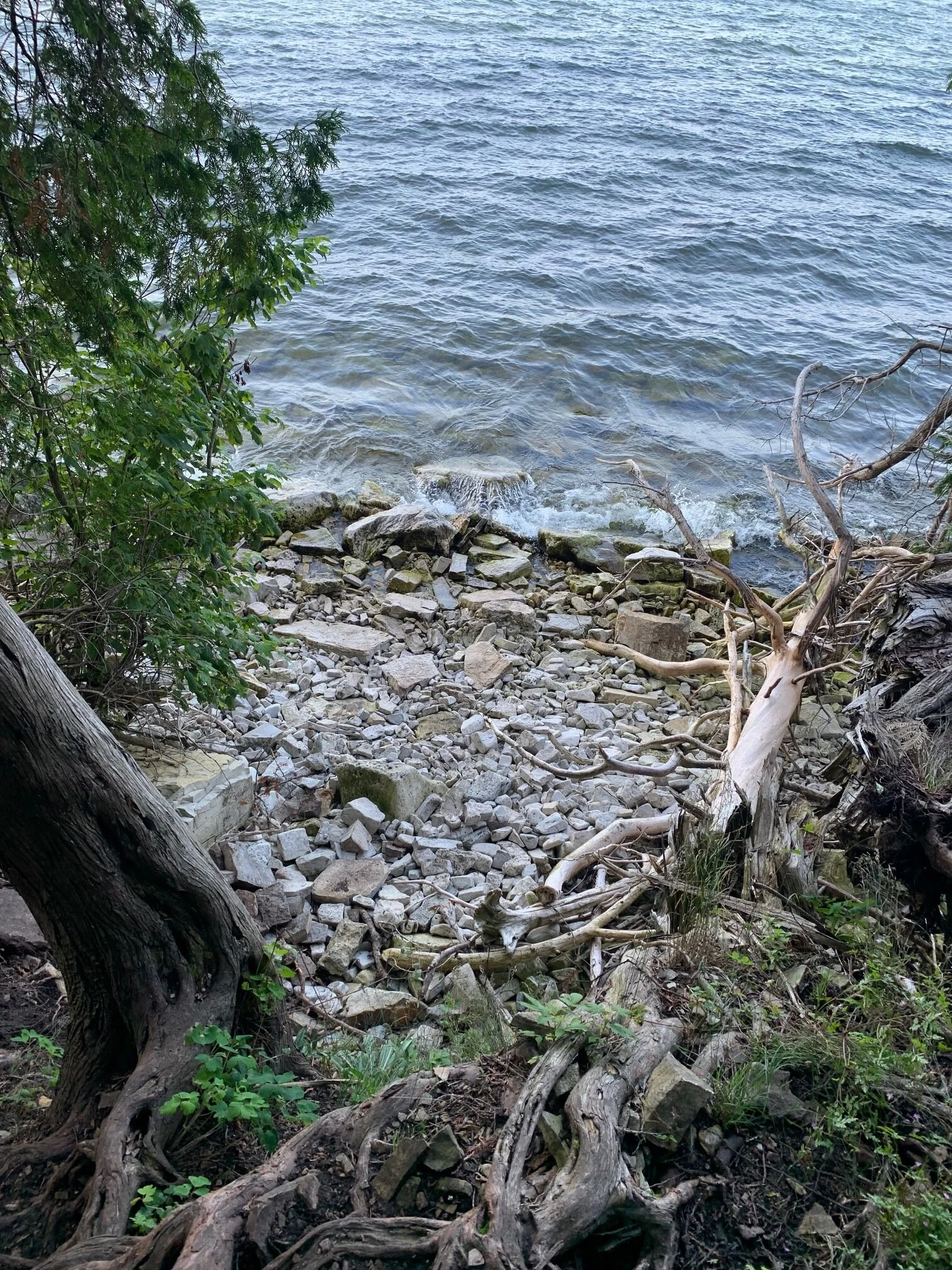
As I neared the base of the trail, the shadows of the forest dissipated and opened to a gleaming rocky shore. Smooth, water-worn stones shone brightly beneath lapping waves. A narrow, uneven path followed the edge of the water, rising and falling with the stone formations at the base of the bluff. I looked upward, processing that I was standing beneath the remnant of an ancient sea wall from another time.
Cliffside wildflowers dotted the smooth grey of the rock in a burst of color, with varieties including trillium, thornberry, bellwort, and leatherwood. As I gazed in wonder of the beauty surrounding me, I took some care to navigate the twisting, writhing ground below with my thickly treaded sneakers, thankful that I had brought semi-decent shoes. I love the thrill of hiking rugged terrain, it really ignites a kind of joy and adventurous spark in me. I also have a very healthy respect for nature, and would advise anyone to be mindful of their ankles on this delightfully challenging path.


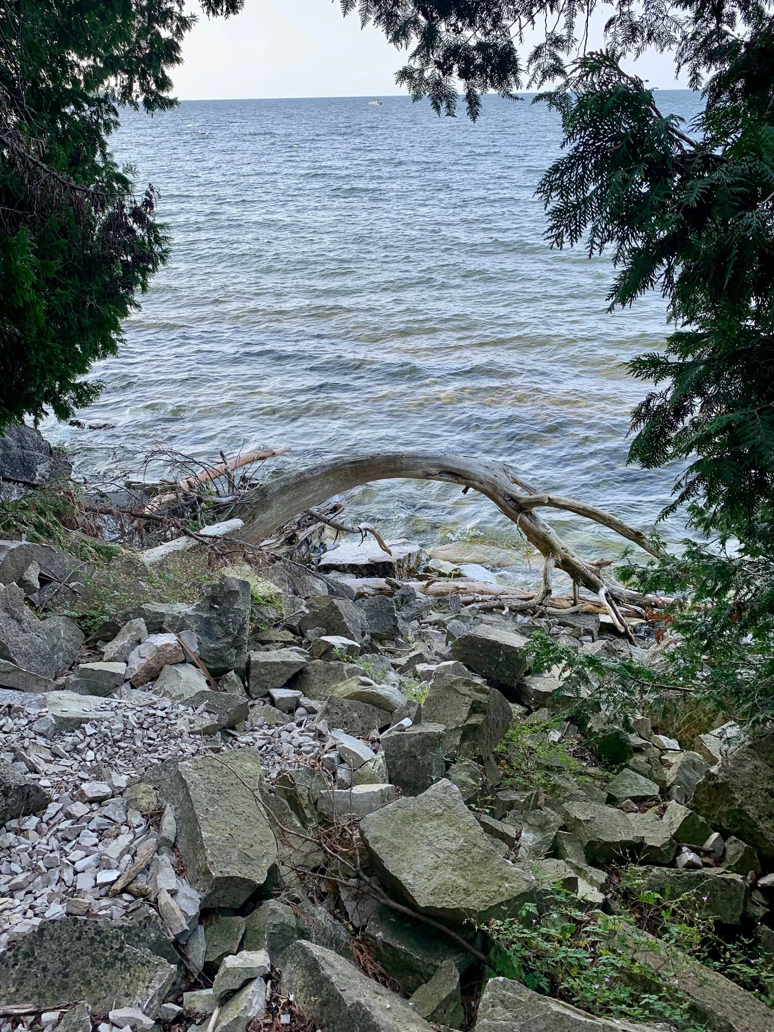


The views across the lake were stunning, as I moved steadily along the stony ground and looked across the watery expanse to my right. One of the joys of the Eagle Trail are all of the small gaps in the embankment that beckon to be explored. It’s a series of secretive pockets, connecting the trail and the lake. I climbed the gentle slope of a twisted cedar trunk to rest for a few minutes, taking in as much of my surroundings as my senses would allow. Shortly after, I passed another large tree surrounded by a small clearing, where people had stacked innumerable stones and made a kind of community zen garden. As I moved ahead, the path widened, and the full height of the bluffs came into view.
There are crevices, caverns, and plenty of climbing opportunities among the driftwood, fallen tree trunks, and boulders clustered at the base of the bluffs. It’s the highlight of the trail, where stone, forest, and lake all merge into a natural playground. I took my time through this part of the hike, to explore the areas around the trail instead of breezing straight through. Views in every direction revealed something beautiful to behold.
Shortly after passing along the base of the bluffs, the ascent to higher ground resumed. I passed back into the sheltering dark of the woodland, marveling at the gravity-defying cliffside trees now disappearing with the afternoon light behind me. I had read that this part of Wisconsin was home to some of the oldest growth forests, due to the phenomenon of cliffside trees. The existence of such trees is an act of defiance: due to poor quality soil and sporadic access to water, their growth is a long and slow process. In some specimens, the space between rings is only a few cells wide. Because they aren’t located on land, they’re generally left alone--protected from the risks that landlocked forest habitats face. Cliffside trees can appear small and scraggly, but are remarkably resilient. In fact, I recently discovered that Wisconsin’s oldest tree is believed to be a red cedar in Greenleaf, growing on the side of a rocky formation. It’s estimated to be approximately 1,300 years old!
My reflections on cliffside trees were disrupted when I saw something shift ahead--a flash of auburn-brown, moving off the path uphill. As I drew closer, I heard a rustling to my left, and saw a doe. She was still, and staring at me--her deep brown eyes wide and attentive. Then, beside her, I noticed another auburn flash. She had two small fawns with her, and they were grazing among the ferns. The trail took a sharp bend as it led uphill, and I was able to essentially wind around them as they grazed. They didn’t run, but kept their distance from all edges of the trail--perfectly centered in the loop. It was now evening, and the brightness of the sun had dimmed to a gentle fade.


This was the final stretch of the trail, before I reached the point where I’d started near the Eagle Panorama. I looked out once more across the water, and then slowly headed back to my car, determined to return to this amazing place and further explore the park.
Article by Jessie Howe: July 28th, 2021
Photos taken at Eagle Trail on July 16th, 2021
